Model Volume is a unique combination of Cross Section, Advanced Volume Comparison, and 3D modeling tools. This all-in-one approach is a first for the online data platform industry, in which Kespry continues to develop products supporting the best end-user experience possible with the highest level of quality and accuracy.
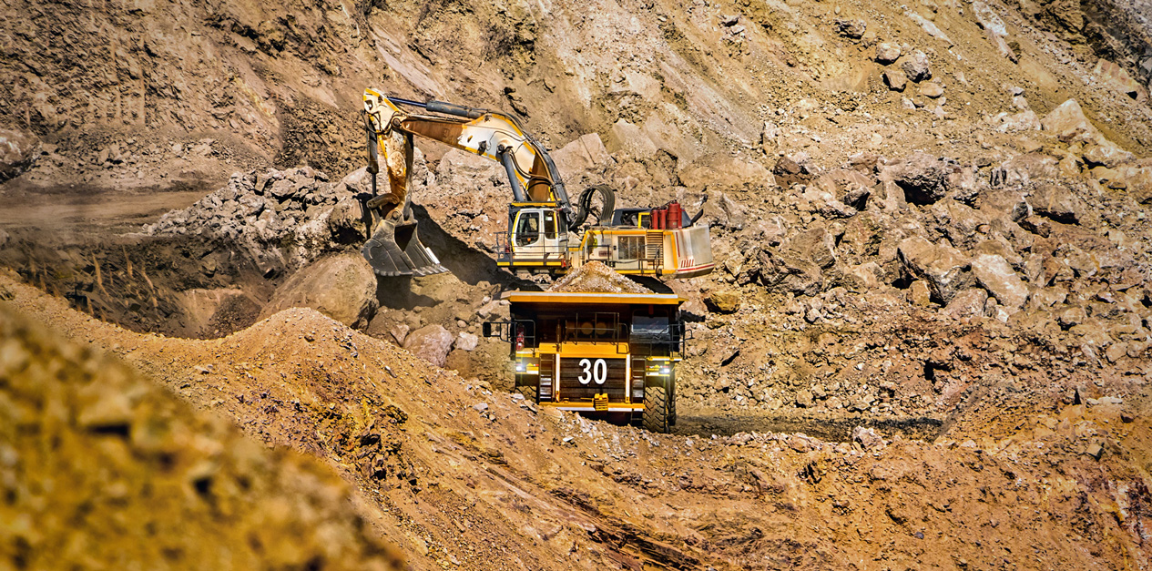
Why was it developed? Site managers for Aggregates, Mining, and Construction sites frequently make time-sensitive decisions to optimize the performance of active and proposed operations to maximize profitability. To understand the site conditions for these high-level decisions, advanced CAD or modeling were needed by surveyors, mine planners, or specialists and often took their valuable time to process and deliver the data back to managers. Or the data was available on online platforms, but lived in multiple functions that didn’t provide the whole picture to easily perform analysis quickly to accurately calculate forecasted or removed stripping, blasting, or excavation areas. Either method takes time and results in lost revenue due to mismanaged equipment, the cost for workers/surveyors time, and less-accurate volume calculations.
Kespry created Model Volume based on its customer feedback, from surveyors, mine planners, and site managers.
“We’re using Kespry for site planning because we want as much accuracy as we can get, specifically that’s helpful on pre-strip and post-strip projects,” Rob Manatt, Project Manager at Wendling Quarries, told us. “It gives us a sense of confidence knowing that we’re using Kespry and are within centimeter accuracy on our volume calculations.”
How it Works:
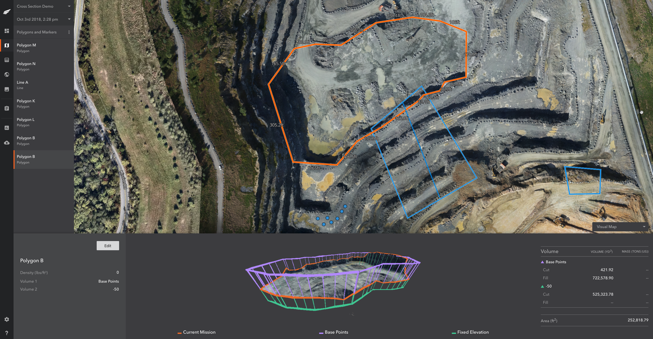
The volume change between known design surfaces, elevations, or previous surveys can be accurately calculated and displayed as a dynamic 3D model.
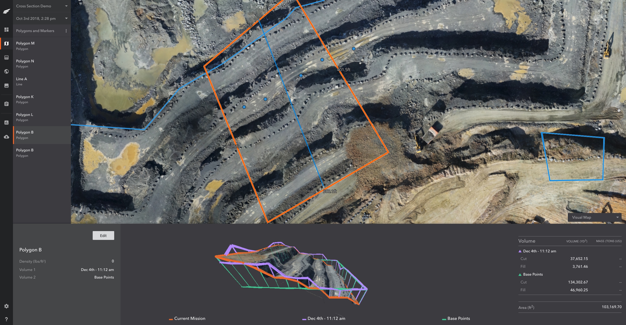
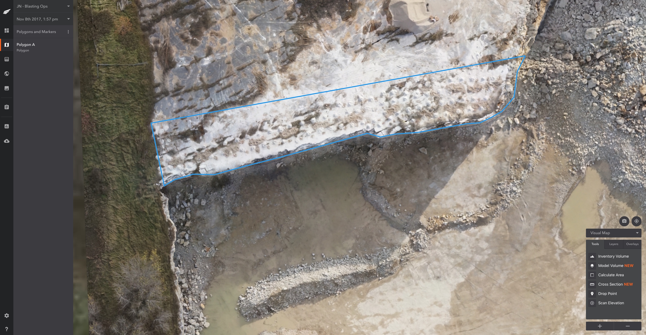
1. Users simply make a few clicks and draw a polygon to identify the areas where they want to calculate changes in volume for proposed or past earthwork extraction activity.
2. Customize the dimensions of your polygon if needed and then select a design surface, fixed elevation, previous mission, or base points to calculate multiple volumes within the selected area.
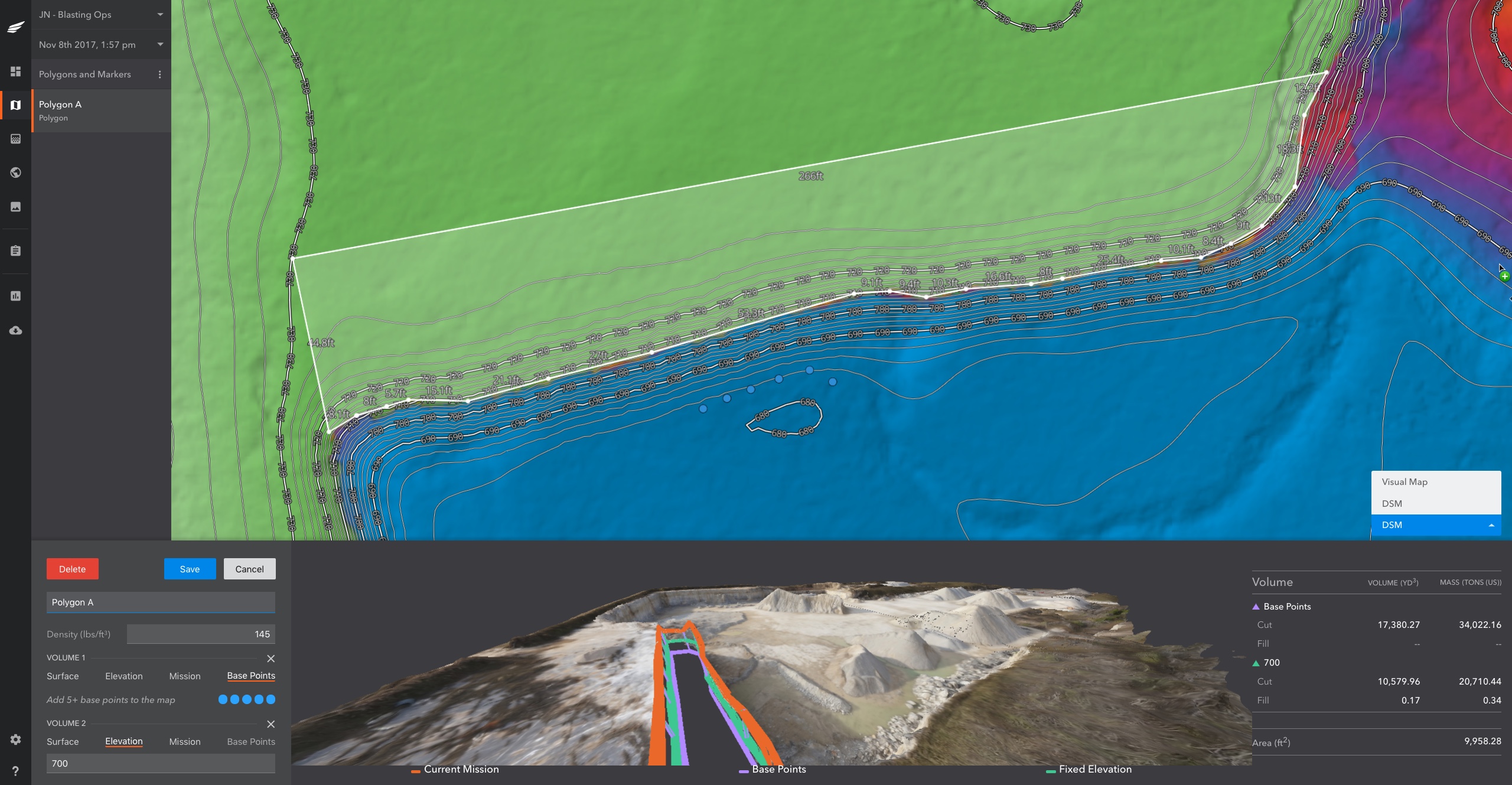
3. Adjust the polygon on the fly and the entire model automatically adjusts in real time. Rotate the 3D model to visually see the volumes automatically calculated.
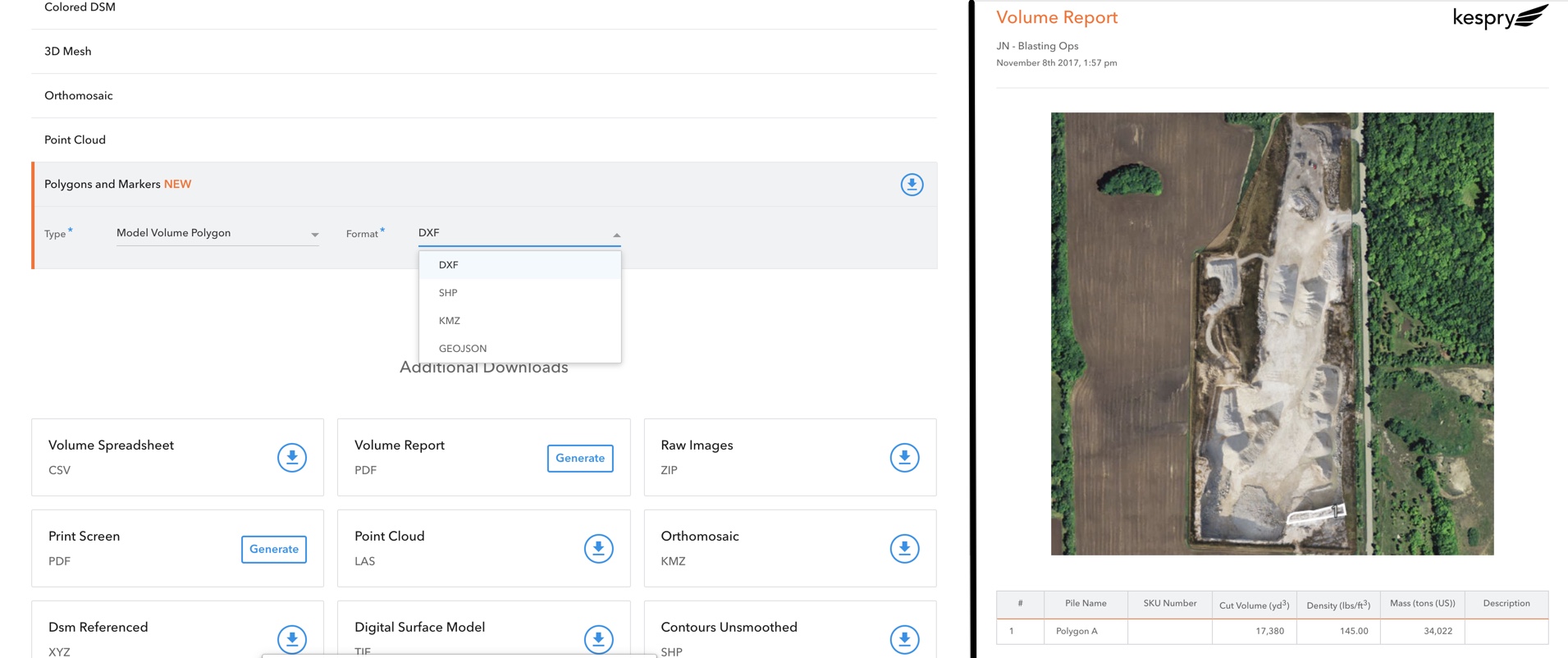
4. Export out your data to a PDF or CSV Volume Report to share with other teams. Additionally, export the polygon as an external file to have displayed in CAD/GIS or non-CAD platforms such as Google Earth.
The aggregates, mining, and construction industries continue to look for ways to improve the accuracy and efficiency of calculating volumes of on-site materials. Drones have become widely adopted in the space and Kespry is leading the commercial industry with the most complete single solution package available. We’re extremely happy to deliver another critical tool that enables them to run their businesses more productively and efficiently.
If you’d like to learn how tools like Model Volume are being used for Site Planning and Mine Operations, listen to our customer’s perspective in this on-demand webinar.