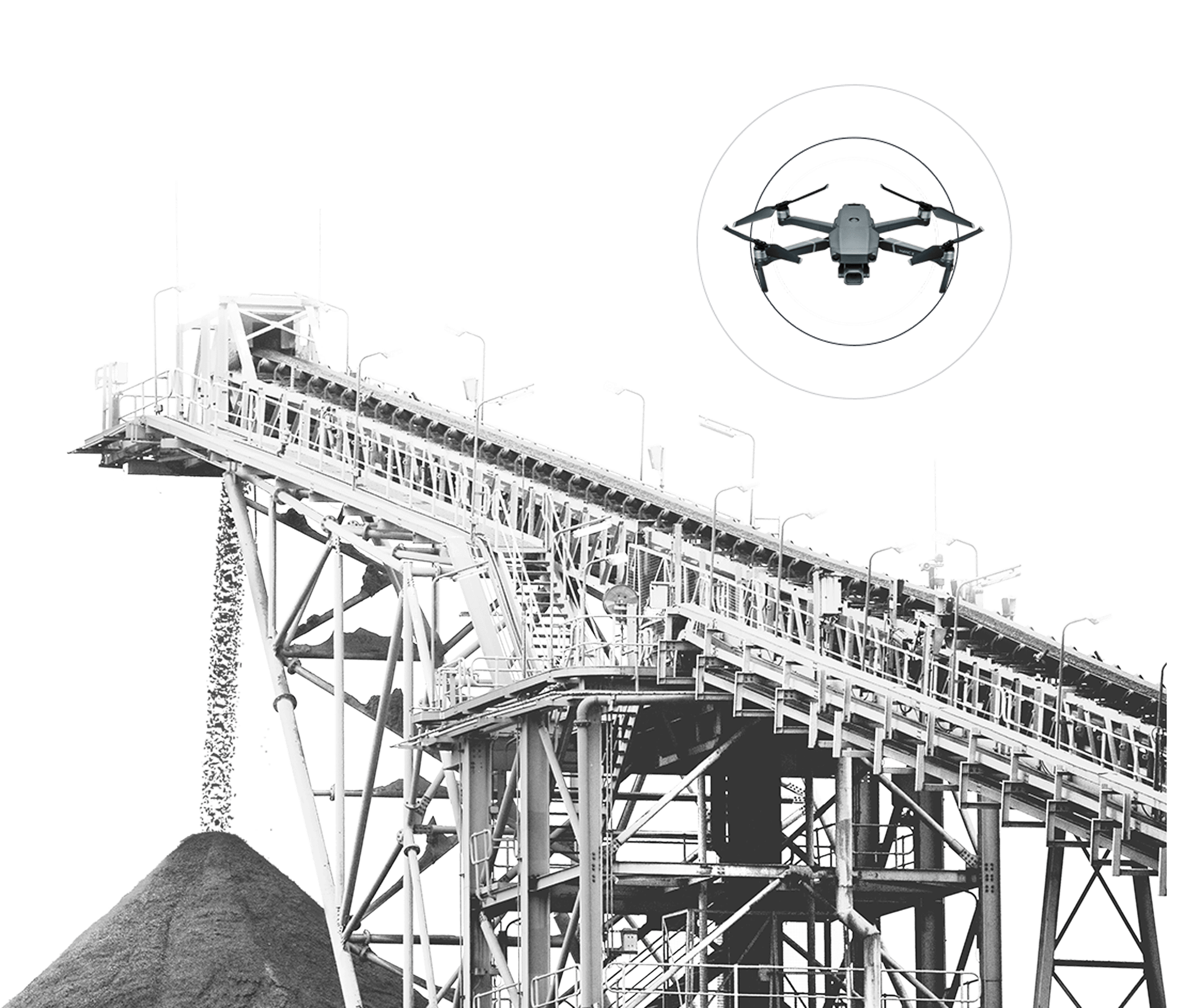
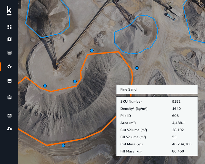
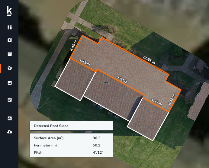
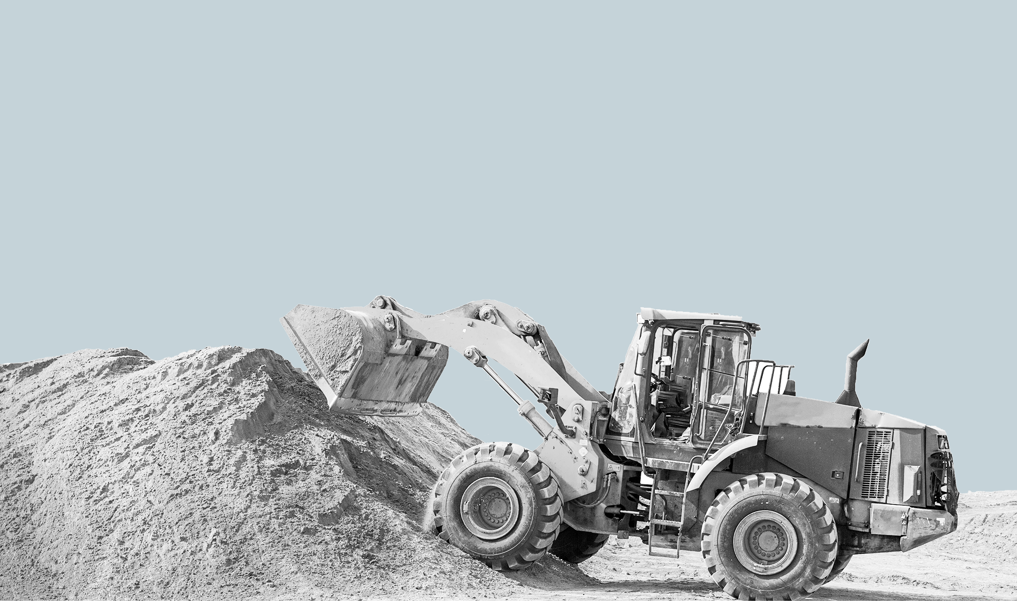
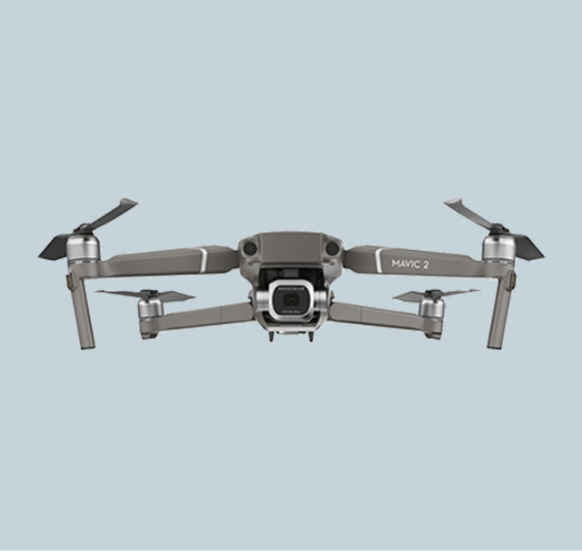
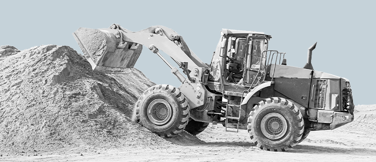
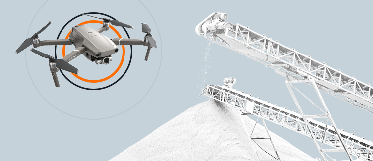
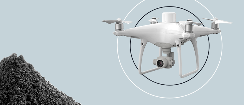
Drone-Based Aerial Intelligence for Mining & Aggregates

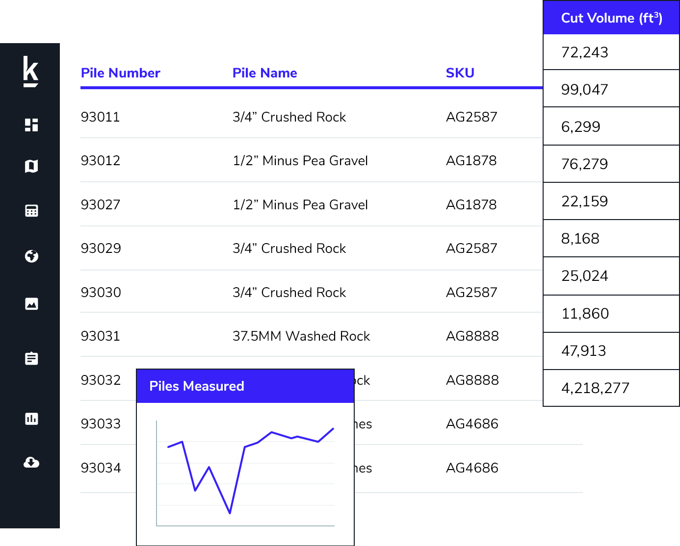
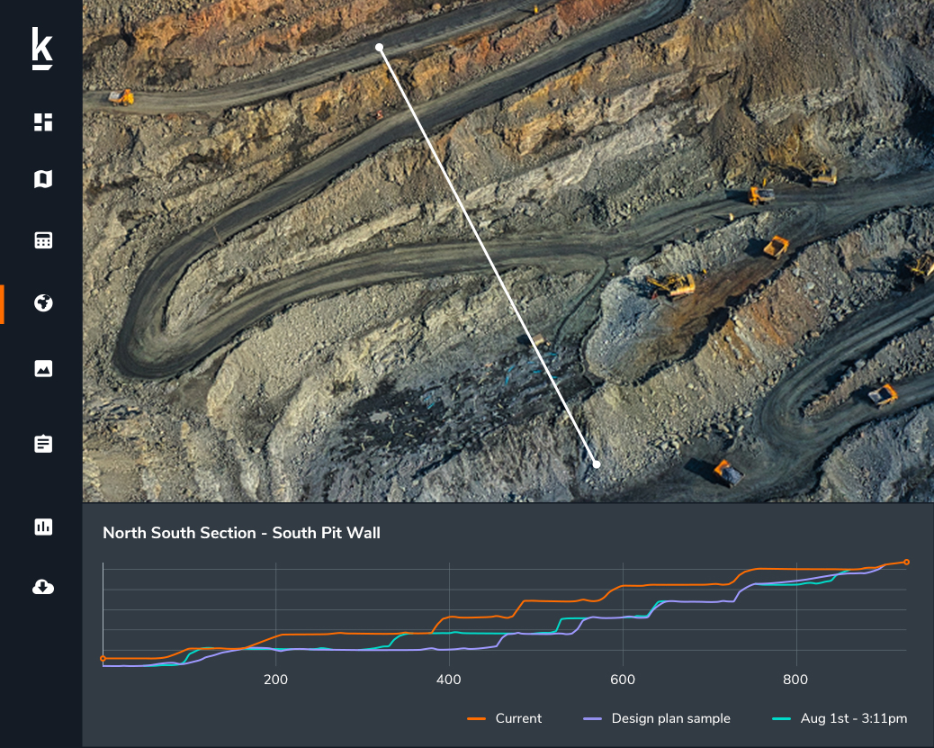
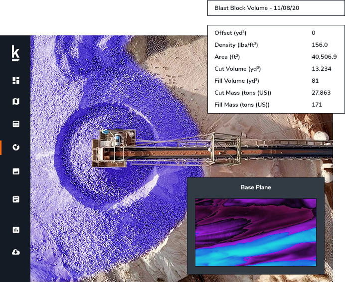
Kespry is the only complete commercial drone and data solution used by the top aggregates producers, pulp and paper and mining companies. Kespry delivers unrivaled simplicity for accurate inventory management and mine planning. See Kespry in action for yourself by clicking the Kespry Cloud trial button.

0

Acres flown in under 30 minutes

0 %

Reduction in labor costs

0 %

Increase in data accuracy

Why Drones Make Mining & Aggregates Businesses More Profitable

Strengthen Inventory Data Accuracy & Reliability

Reduce costs and strengthen inventory confidence with highly accurate data

When it comes to assessing credible and accurate volume calculations, the type of equipment and method of data processing will have significant impact. Traditional surveying methods like walking around a site to take manual measurements have been proven to deliver limited accuracy. By introducing drone technology, you are able to bring your operations into a new era.

Increase Frequency & Consumption

Easily capture data to identify patterns and make intelligent decisions

To make intelligent business decisions, aggregates and mining companies need more than just accurate data – they need access to timely, consistent data in order to identify trends and observe larger patterns. The Kespry system can be deployed on-demand, up to six times faster than traditional survey methods. Quick and easy to use, it encourages more frequent and regular data capture, at a more granular level.

Improve Worker Safety

Protect employees by using an automated system that operates above the worksite

Employees are the most valuable and important asset of any company, but the reality of the aggregates and mining industry is that it can be dangerous. Operating heavy equipment at high speeds and doing manual surveys on or near active traffic areas and hazards such as highwalls can pose great physical risk to workers. Kespry allows businesses to better protect their workers by using a completely autonomous system to collect high-resolution imagery from safely above active operation sites.

Use Cases
  • Inventory Management
  • Mine Planning

Inventory Management

Customers use Kespry to autonomously measure stockpile volumes and manage inventory across all their sites because it produces data that is up to 80% more accurate than manual measurement or using other drone solutions. All their survey data is stored in one central cloud application. The data is accessible by the entire team for analysis and can also easily be used in their operational systems.

Learn More

Mine Planning

With survey-grade accuracy, data from Kespry is used to calculate earthwork quantities and update mine plans with daily topography changes in active areas. These highly-accurate data sets are captured in as little as 30 minutes with no need to use multiple, cumbersome ground control points or to have a survey or walk the site.

Learn More

Coal Mining

With regular flights using the Kespry solution, material removed from a shaft, incline, adit, or opencast mine is easily tracked in the Kespry Cloud.

  • Manage wasterock and ore stockpile inventories
  • Generate cut-and-fill reports for dragline operations
  • Evaluate slope stability on active highwalls
  • Reclamation planning
  • Verify blasting pattern locations

Frac Sand Mining

Accurate data from the Kespry solution allows frac sand companies to track the entire extraction process from sandstone blasting to sludge stockpile inventory management.

  • Calculate cut and fill volumes
  • Evaluate production output of all materials
  • Manage stockpile inventories
  • Support hydrogeologic studies, pit designs, stockyard designs and slope stability analysis
  • Layout blasting pattern locations

Gold Mining

The Kespry system allows companies to frequently collect volumetric and topographic data for the entire mine site during ongoing operations.

  • Manage stockpile inventories
  • Calculate stripping volumes
  • Perform safe high-wall inspections
  • Determine stripping ratios and overburden thickness
  • Identify drainage patterns and perform catchment area modeling

Ore Mining

The Kespry system allows mining companies to frequently collect accurate aerial data for surface analysis and volumetric calculations throughout ongoing mining operations.

  • Calculate cut and fill volumes
  • Manage stockpile inventories
  • Evaluate production output of all materials
  • Safely evaluate geophysical hazards and high wall inspections
  • Identify drainage patterns and catchment areas area modeling

With regular flights using the Kespry solution, material removed from a shaft, incline, adit, or opencast mine is easily tracked in the Kespry Cloud.

  • Manage wasterock and ore stockpile inventories
  • Generate cut-and-fill reports for dragline operations
  • Evaluate slope stability on active highwalls
  • Reclamation planning
  • Verify blasting pattern locations

Accurate data from the Kespry solution allows frac sand companies to track the entire extraction process from sandstone blasting to sludge stockpile inventory management.

  • Calculate cut and fill volumes
  • Evaluate production output of all materials
  • Manage stockpile inventories
  • Support hydrogeologic studies, pit designs, stockyard designs and slope stability analysis
  • Layout blasting pattern locations

The Kespry system allows companies to frequently collect volumetric and topographic data for the entire mine site during ongoing operations.

  • Manage stockpile inventories
  • Calculate stripping volumes
  • Perform safe high-wall inspections
  • Determine stripping ratios and overburden thickness
  • Identify drainage patterns and perform catchment area modeling

The Kespry system allows mining companies to frequently collect accurate aerial data for surface analysis and volumetric calculations throughout ongoing mining operations.

  • Calculate cut and fill volumes
  • Manage stockpile inventories
  • Evaluate production output of all materials
  • Safely evaluate geophysical hazards and high wall inspections
  • Identify drainage patterns and catchment areas area modeling

Kespry Aerial Intelligence Platform

We’re trusted by our customers because we provide a drone data and analytics solution for market leaders in mining and aggregates, insurance and roofing businesses.


Current Drones Compatible with Kespry Cloud

DJI Mavic 2

DJI Mavic 2

The DJI Mavic 2 Pro drone integrates with Kespry software, service, and supports to achieve a quick and easy field to finish experience.

  • Quick and frequent surveys
  • High accuracy results
  • Audit approved inventory data
  • Kespry App mobile flight planning

DJI Phantom 4

DJI Phantom 4

The DJI Phantom 4 RTK integrates with Kespry software, without the need for aerial targets, multiple control points or data transfer for post-processing.

  • Survey grade accuracy
  • Increased site survey frequency
  • Improve safety and operation efficiency
  • Kespry Cloud integration

WingtraOne

WingtraOne

The WingtraOne drone integrates with Kespry software, an ideal drone for performing accurate, large-scale site surveys.

  • Large-scale site surveying and mapping
  • Survey grade accuracy
  • Operations and inventory monitoring
  • Kespry Cloud integration

eBee

eBee

The eBee drone integrates with Kespry software and analytics, a drone solution for accurate, large-scale site surveys.

  • Large-scale site surveying and mapping
  • Survey grade accuracy
  • Operations and inventory monitoring
  • Kespry Cloud integration

DJI Mavic 2

The DJI Mavic 2 Pro drone integrates with Kespry software, service, and supports to achieve a quick and easy field to finish experience.

  • Quick and frequent surveys
  • High accuracy results
  • Audit approved inventory data
  • Kespry App mobile flight planning

DJI Phantom 4

The DJI Phantom 4 RTK integrates with Kespry software, without the need for aerial targets, multiple control points or data transfer for post-processing.

  • Survey grade accuracy
  • Increased site survey frequency
  • Improve safety and operation efficiency
  • Kespry Cloud integration

WingtraOne

The WingtraOne drone integrates with Kespry software, an ideal drone for performing accurate, large-scale site surveys.

  • Large-scale site surveying and mapping
  • Survey grade accuracy
  • Operations and inventory monitoring
  • Kespry Cloud integration

eBee

The eBee drone integrates with Kespry software and analytics, a drone solution for accurate, large-scale site surveys.

  • Large-scale site surveying and mapping
  • Survey grade accuracy
  • Operations and inventory monitoring
  • Kespry Cloud integration

Request a Demo

Ready to see how Kespry’s drone-based Aerial Intelligence platform enables you to rapidly and accurately survey and analyze stockpile inventories, comprehensively track large-scale worksites across industries, and inspect residential and commercial rooftops? Request a demo now and we’ll show you how our platform can work for you.

Request Demo