From measuring stockpiles in minutes to expediting mine planning to safely capturing data from unsafe areas, here are three of the many reasons why aggregate companies are embracing drone technology.
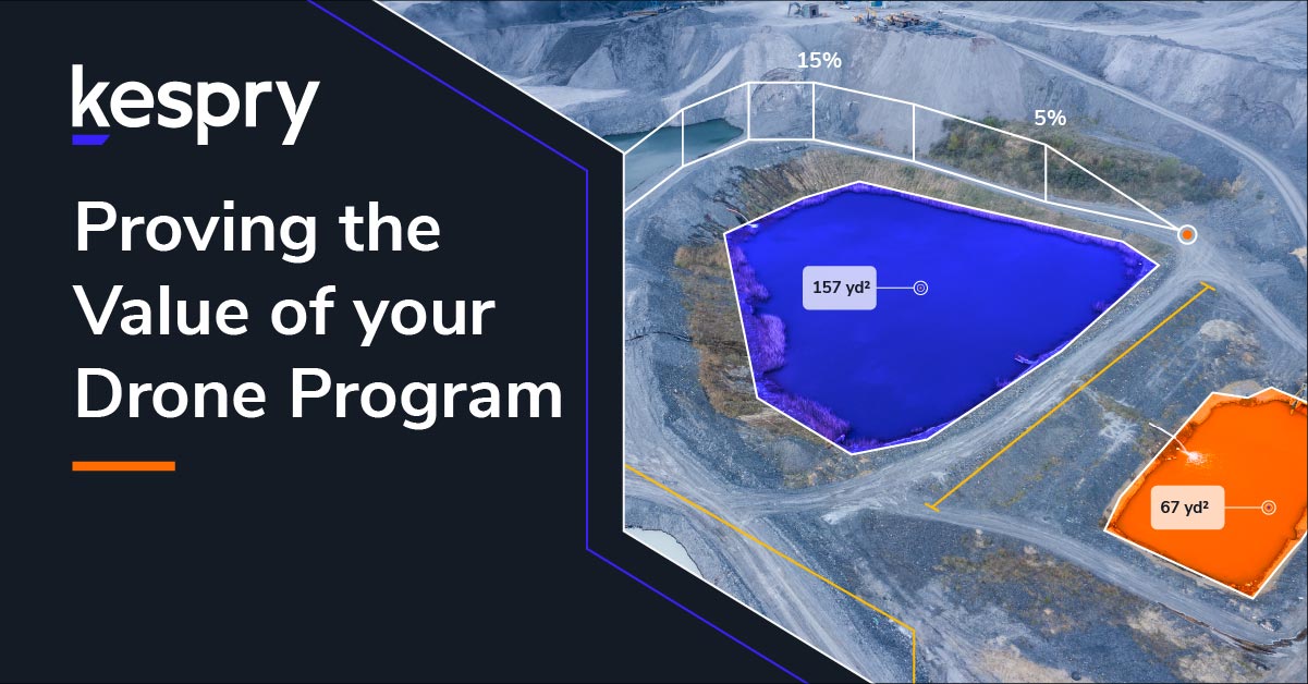
Using the Kespry Cloud, it takes one minute to measure a stockpile.
1. Stockpile measurement in under a minute
Many aggregates companies use a combination of employees on the ground and third-party surveyors to measure stockpiles. Surveys happen a few times a year, using a variety of surveying equipment, and take anywhere from a few days to a week to complete. This method is costly, hazardous and time-consuming. Plus the data isn’t immediately available. Even when the data does become available, it can be hard to share within the company or to audit.
Time for a better way to get that important data. Enter, drones. By using drones, companies can frequently and automatically calculate the perimeter and volume for all their aggregate stockpiles; even the odd-shaped piles against walls. With a drone, they can fly a large site in minutes and have pile measurements that same day. Data captured by drones is being used for everything from daily production measurements and spot checks to end of year audits.
“With the drone we can get a cost-efficient and accurate measurement of our stockpiles every month, versus the quarterly measurements we were getting before.” – Mike Moy, Operations Specialist, Lehigh Hanson
Whitaker Contracting is leading the way in aggregate measurement and tracking. By using drones, Whitaker’s combined yearly cost is 22% less than before. They’re measuring their stockpiles twice as frequently, while spending four times less time.
“In my opinion, the drone paid for itself the first time I used it.” – John Davenport, Project Manager, Whitaker Contracting
2. Mine Planning at the Speed of Flight
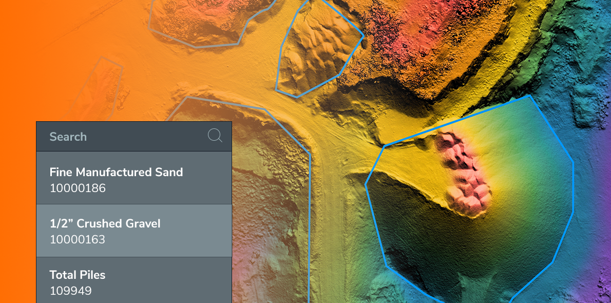
Due to the high cost of manned aerial surveys, many companies may only do an aerial survey once a year, while using ground-based surveyors in between. In search of a way to collect data on any site at any time, companies are incorporating drones into the mine planning process. They’re finding value in the 2D and 3D models created from data captured by drones. Companies are also using drones to compare volume measurements from stripping, takeoffs and mine reclamation work, as well as to estimate levels of reserves.
APAC-Central (Oldcastle) is a great example of a company embracing the benefits drones can offer. David Lloyd, Mine Planning Engineer, needed a full topographic survey of a disused pit so his team could do their initial cut and fill and engineering design.
Instead of using a scanner system, having a meeting to plan where they’d drive roads with a dozer, spending a few days driving those roads and spending a full day driving the scanner around – they used their drones as part of the Kespry Aerial Intelligence platform and were on-site for just two hours total.
“It used to take three to five people involved in an operation to get decent survey data and it would often take hours and hours. Now it’s one person and thirty minutes.” – David Lloyd, Mine Planning Engineer, APAC-Central (Oldcastle)
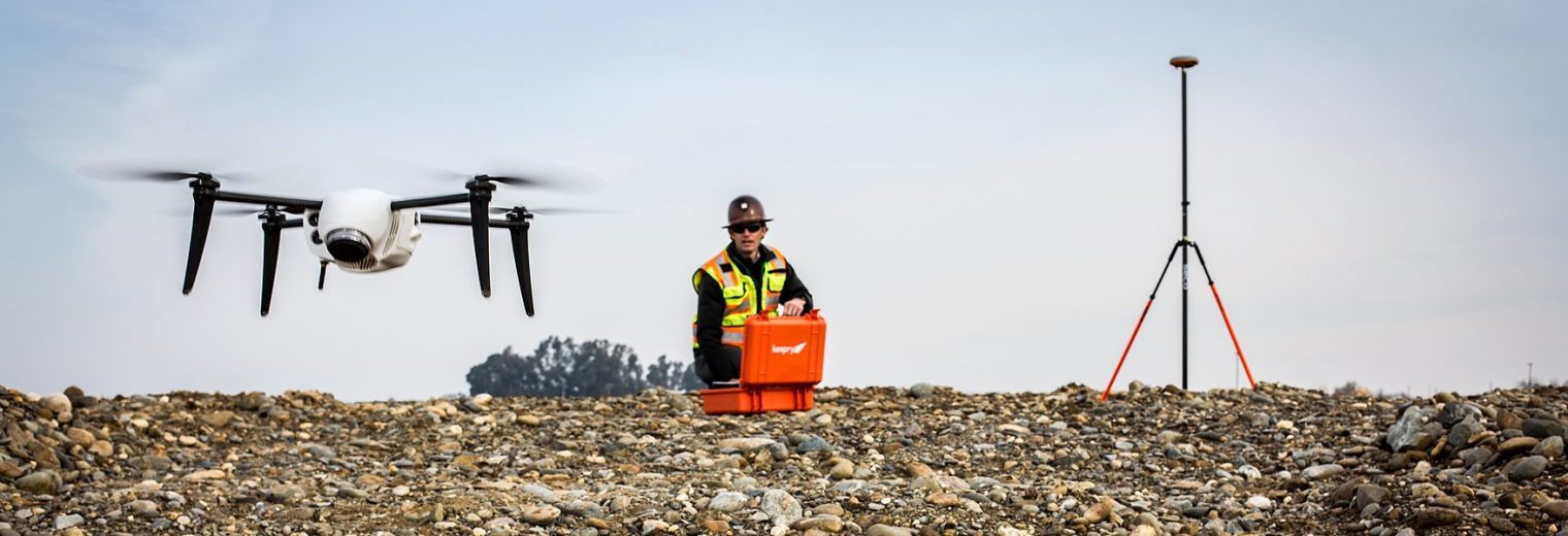
3. Remotely Access Unsafe Areas
For staff at aggregate companies, doing inventory means having to climb up and down stockpiles, while carrying heavy equipment. This often results in tripping, falling or sliding. Using drones means that staff no longer need to put themselves in harm’s way and can collect all the data they need from a safe distance.
“The biggest thing for us is the large emphasis on safety and the safe collection of information.” – Jon Layne, Business Development Manager, Sully-Miller
Want to learn how the leading aggregate companies are seeing a clear ROI with industrial drone solutions?