
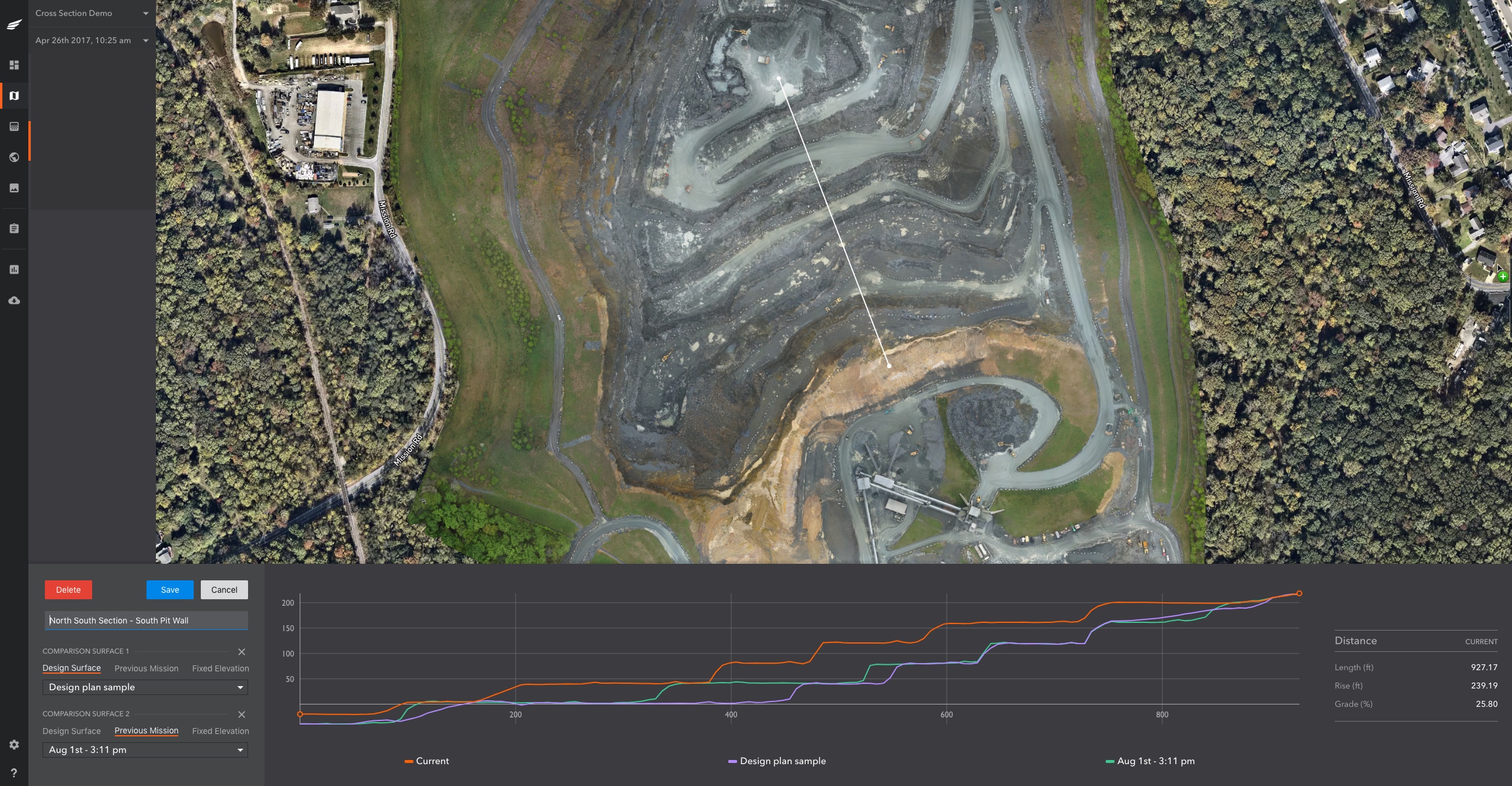
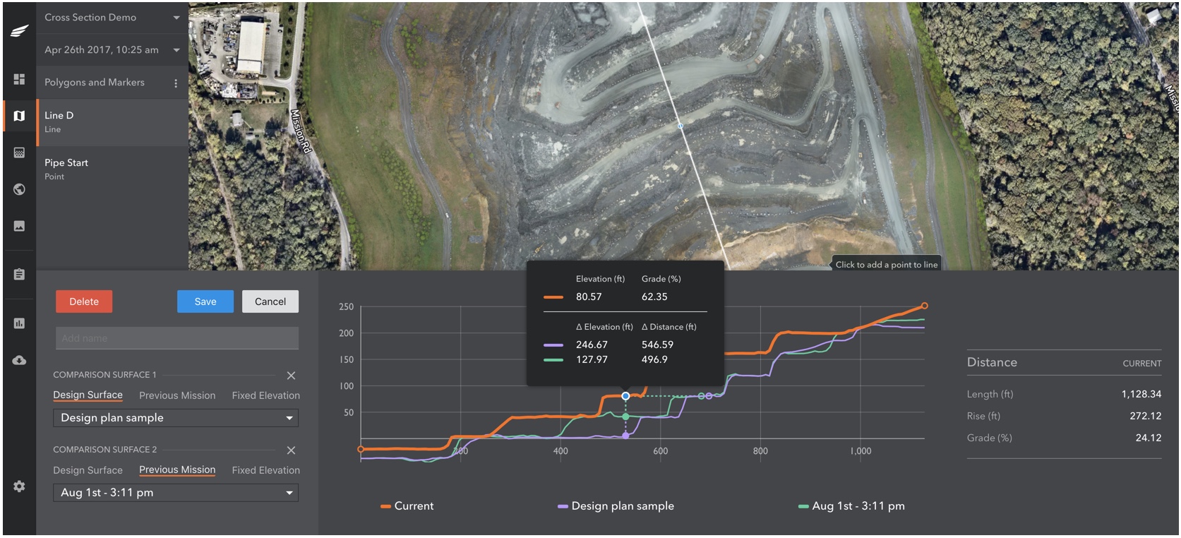
More accessible data leads to better business decisions–something our customers always relay to us. We’ve addressed that in greater depth by releasing Cross Section for aggregates, mining, and construction. Cross Section is a new tool in the Kespry Cloud that auto-generates an elevation profile along any line users capture. But it’s not just a simple “elevation profile” of the current site conditions. Users can compare several surfaces and determine elevation changes needed to stay on track or adjust earthwork operations as necessary.
With Cross Section, site managers and supervisors are more empowered to quickly perform grade checks without tasking in-house survey teams or hiring third-party services. Accurate, yet easily-accessible tools like Cross Section help speed up time-critical decisions that managers need to make, allowing engineers and site surveyors to optimize their time for more in-depth planning and designing typically done in modeling and CAD software.
How it Works
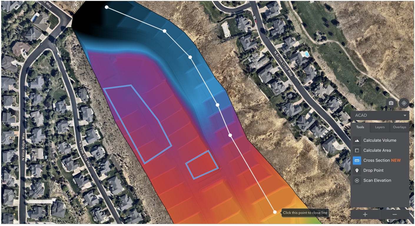
Any surface that has been uploaded (DXF, TIFF, etc) to the Kespry Cloud or any Kespry-flown survey can be viewed as an elevation profile by creating a cross section line across the site.
1. Users simply make a few clicks to draw the cross section where they want to see elevation changes.
2. Select your design file surface and other flights to compare elevations, determine grades, and measure distances at any point on the line between surfaces. Adjust the cross section on the fly and the entire model automatically adjusts in real time.
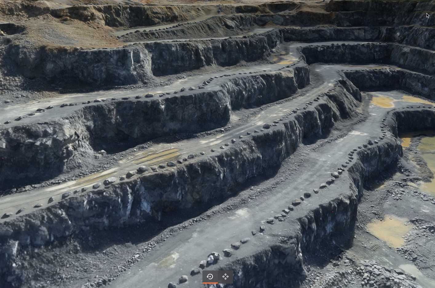
3. Use the interactive 3D model to visualize the entire cross section for a complete experience and reference.
Key Cross Section Use Cases
- Calculate current grade – Take measurements on haul roads, benches, and building pads to provide frequent spot-check information to teams and subcontractors performing the work.
- Compare progress tracking – Determine the remaining work needed to be completed toward final design (reserve models, geologic plans, mine plans, grading plans, reclamation, or as-builts) and optimize earthwork scheduling and contractor sequencing.
- Compare work performed – Estimate the amount of work performed between previous flights or design files to improve profitability with accurate payout data.
- Evaluate current site conditions and provide updates Keep leadership and other vested teams in the loop more frequently and granularly.
The aggregates, mining, and construction industries continue to look for ways to improve the accuracy and efficiency of calculating volumes of on-site materials. Drones have become widely adopted in the space and Kespry is leading the commercial industry with the most complete single solution package available. We’re extremely happy to deliver another critical tool that enables them to run their businesses more productively and efficiently.
If you’d like to learn more about Cross Section, please reach out to us at: hello@kespry.com