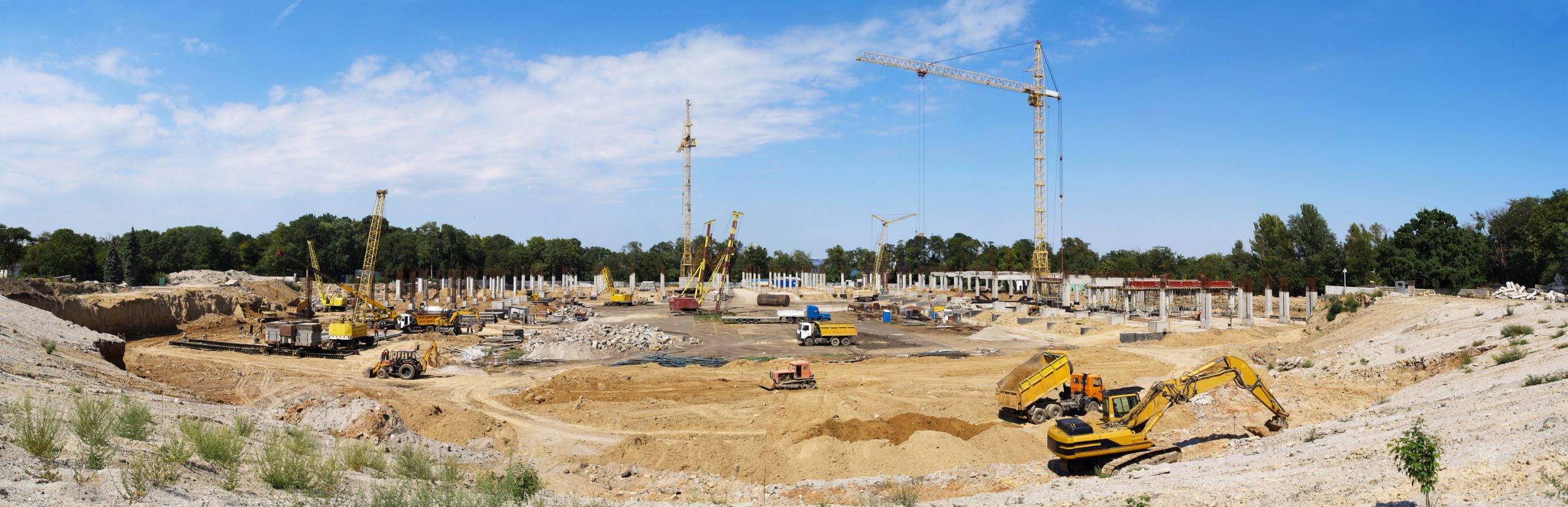
Once Again, Kespry continues to offer the most value for their customers by delivering a new tool—feature extraction. The tool uses machine learning (ML) and artificial intelligence (AI) to automatically remove equipment from the topographic model automatically generated from Kespry drone flights over active construction and mining sites.
Like most of the new features Kespry releases, feature extraction was developed using the knowledge base of in-house industry experts as well as direct customer feedback—ensuring customers maximize their ROI with a solution that fits within existing workflows.
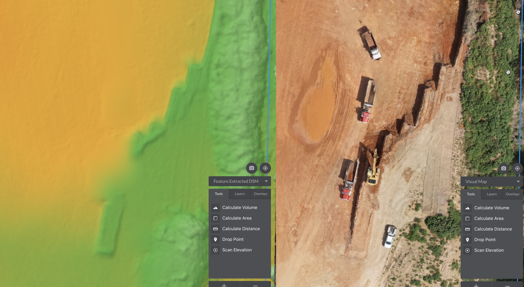
With extracted features, project managers are able to calculate volumes with higher confidence and produce cleaner more accurate volume reports. Engineers and surveyors leverage the new tool by directly downloading feature extracted digital surface model (DSM) data to update grading or mine plans quickly—saving significant time not having to not manually trim or clean up datasets.
How it works
The tool is used once aerial data has been automatically processed in the Kespry cloud. ML and AI algorithms identify equipment within the original flight DSM and then skillfully removes those “trained” features. Customers will now have a choice to see the original (autogenerated) DSM or see the DSM with features removed—in a quick and easy dropdown menu.
Now, customers can:
- Calculate volumes without features for a single flight—Toggle between surfaces in the toolbar to measure volumes and visualize the DSM without equipment
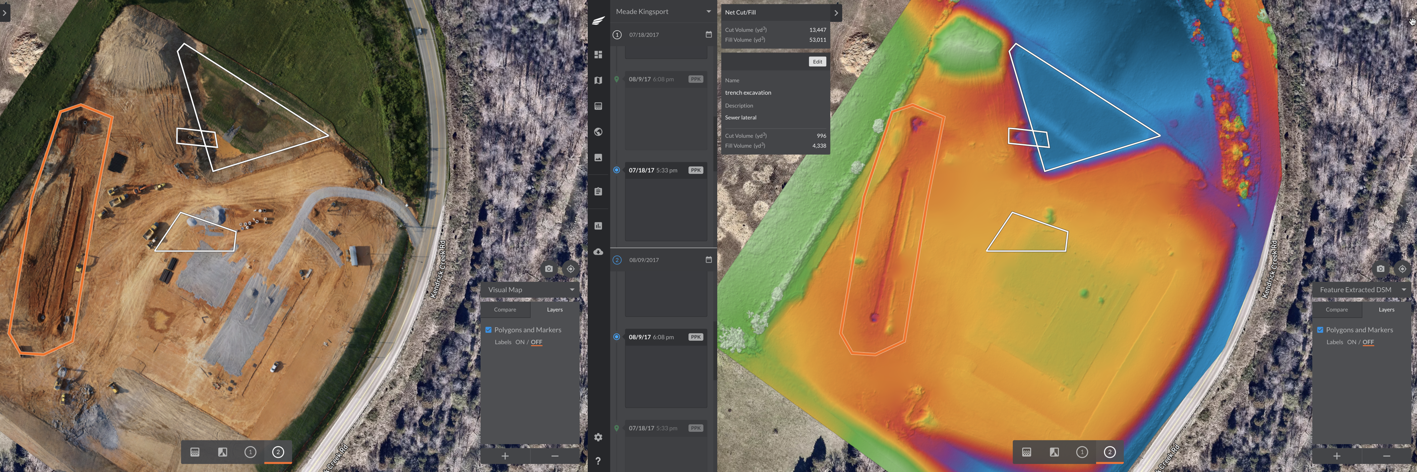
- Calculate volumes without features when comparing to two flights—Perform cut and fill calculations and compare two surfaces that have features automatically removed
- Calculate volumes without features when comparing to a design file—Once a design file surface has been uploaded, cut and fill calculations without features can be made between any selected flight and the base surface.
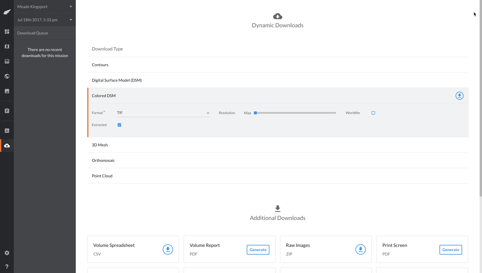
- Directly export feature extracted data to 3rd party softwares—Using the dynamic download option common CAD, GIS and point data file types are available to export with features removed.
Thoughts for the future
What about vegetation and other applications for feature removal? Kespry is focused on providing a product to its customers that delivers the most value in the most reliable and accurate method—using current sensor technology available.
Vegetation is tricky and typically requires more penetrable sensors such as 3D LiDAR. Photogrammetry is not ideal to remove vegetation and can lead to significant inaccuracies over large interpolated areas.
In the future, the feature extraction tool will expand as newer sensor technologies become incorporated into Kespry platform. And as our customers continue to fly frequently, our algorithms will become smarter, further increasing the accuracy and ability to remove additional features.
Please visit our Construction page for more information.